Ultimate SW300 Digital Map – 110+ South West 300 Sights on Google Maps | Southwest Scotland Interactive Road Trip Route Planner
£7.99
If you want every stop on the South West 300 already pinned and ready to navigate to, this is the digital companion built for the road.
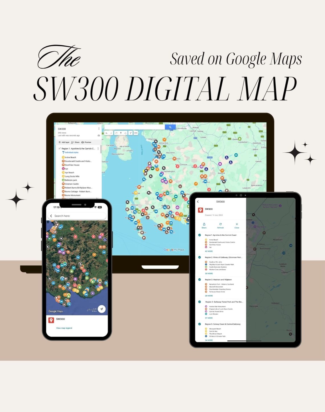
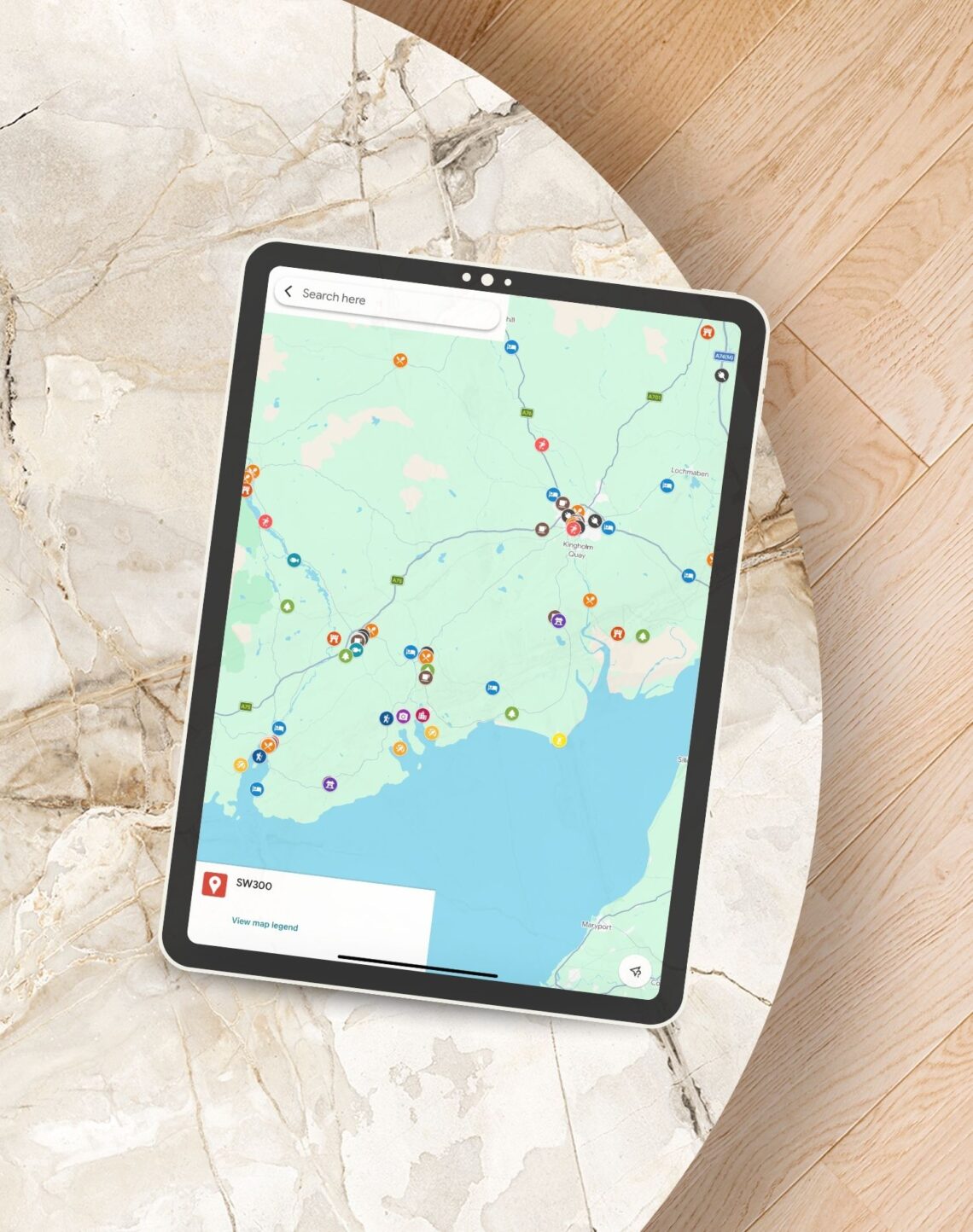
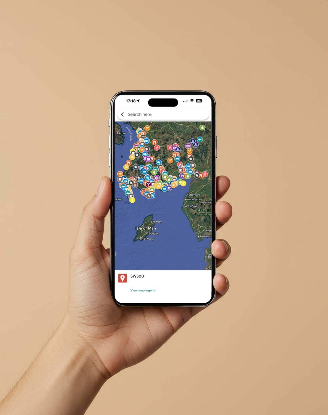
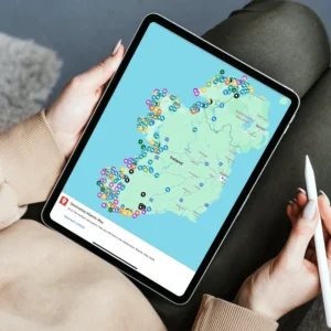
This SW300 Digital Map is a complete Google Maps file featuring 110+ curated stops, sights, and hidden gems from the South West 300 route. Added instantly to your own Google Maps account, it gives you a ready-to-use southwest Scotland route planner that works on your phone, tablet, or desktop – before you leave and every mile of the journey.
No data entry, no searching for locations one by one. Every stop on the South West 300 is already pinned – from Galloway Forest Park and the Rhins of Galloway to the Solway Coast and Burns Country. Navigate directly from each pin, save your favourites, and plan your days without the guesswork.
Created by Campbell and Gemma Kerr of Highlands2Hammocks (Destination Earth Guides), this digital map is drawn from the same firsthand research behind the Destination SW300 guidebook. Every pin reflects a location they’ve personally visited and verified – the kind of ground-level detail that takes the hard work out of planning your southwest Scotland road trip.
Works alongside the Destination SW300 guidebook and physical map, or on its own as a standalone Scotland road trip planner. Whether you’re planning your route from home or navigating in real time on the road, it gives you instant access to the full route in a format your phone already understands. It also makes a simple and practical digital gift for travel – delivered instantly, no postage required.
SW300 Digital Map Features:
- Instant Access, No Waiting: Delivered to your inbox and added to your Google Maps account in minutes – ready to use before your trip has even started, with no delivery times or postage costs.
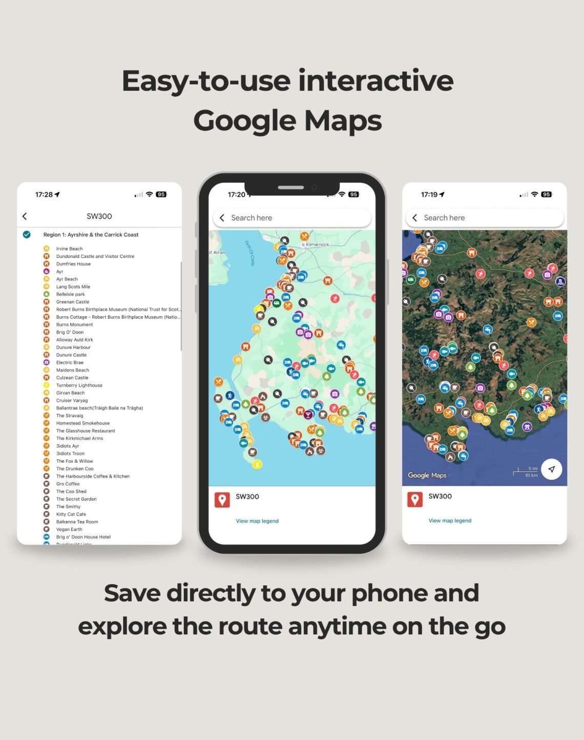
- 110+ Locations Already Pinned: Every curated stop from the South West 300 is marked and ready to navigate to, from major sights to the hidden spots most travellers never find.
- Works on Any Device: Access your southwest Scotland route planner on your phone, tablet, or desktop – and download for offline use so signal blackspots on the route don’t leave you guessing.
- Built from Real Experience: Created by Campbell and Gemma Kerr after personally driving and exploring the South West 300, every pin reflects a location they know firsthand.
- Perfect Alongside the Guidebook: Works as a standalone digital travel planner or pairs naturally with the Destination SW300 guidebook and physical map for a complete planning toolkit.
Main Features
- 110+ South West 300 sights and stops pinned on Google Maps
- Instant digital delivery – no waiting, no postage
- Works on phone, tablet, and desktop
- Download for offline use – no signal required on the road
- Covers Galloway Forest Park, Rhins of Galloway, Solway Coast, and Burns Country
- Navigate directly from each pin with one tap
- Created from real travel experience by Campbell and Gemma Kerr
- Works alongside the Destination SW300 guidebook and physical map
- A practical digital gift for travel lovers
- Instant access from the moment of purchase
Everything on the South West 300, pinned and ready to go. Your interactive southwest Scotland route planner for the road ahead.
You may also like…
-
- Sale!
Destination Skye Guide Book
- Original price was: £22.99.£18.99Current price is: £18.99.
- Add to basket

Related products
-
- Sale!
The Ultimate Wild Atlantic Way Digital Map
- Original price was: £7.99.£5.99Current price is: £5.99.
- Add to basket


Reviews
There are no reviews yet.