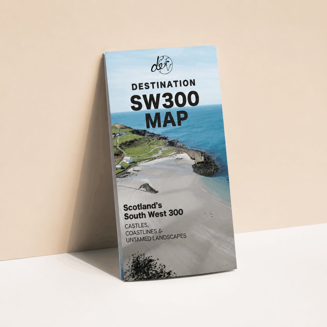
SW300 Map: The First South West 300 Road Trip A1 Map & Route Planner – Southwest Scotland Map, Motorhome Scotland Guide & Travel Planner
£8.99
In stock
If you’re driving the South West 300, you’ll quickly find that the best moments happen on roads where phone signal disappears just when you need directions most. Digital maps are useful for planning, but there’s nothing quite like having a physical SW300 map spread out on the dashboard that shows you the whole route at a glance.
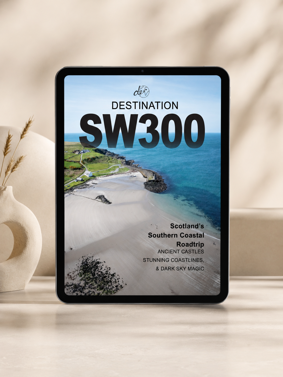
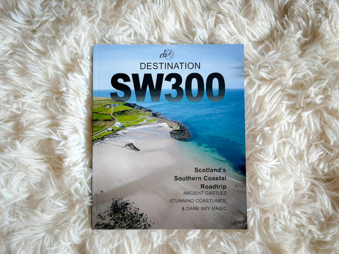
The first dedicated South West 300 Map is more than just a piece of paper. It’s a travel planner and route guide designed to help you navigate 300 miles of southwest Scotland with confidence – from Galloway Forest Park and the Rhins of Galloway to the Solway Coast and Burns Country. With 110+ sights and stops marked clearly, this southwest Scotland map ensures you don’t miss a hidden beach, a dark sky viewpoint, or a quiet coastal pull-in that most travellers drive straight past.
Designed to be used on the road as well as before you go, it also works as a practical travel planner. Mark where you’ve been, note the spots you want to return to, and build a record of your own South West 300 journey.
Created by Campbell and Gemma Kerr of Highlands 2 Hammocks (Destination Earth Guides), this map is drawn from real experience driving, walking, and exploring the route. It’s built with the practical details that standard maps leave out – campervan-friendly stops, overnight Stops, and local knowledge that only comes from time spent on the road.
It also makes a thoughtful choice for motorhome gift ideas or gifts for travel. If you’re looking for motorhome gifts for couples or practical gifts for motorhome owners heading to southwest Scotland, this is a map they’ll actually use every day of the trip.
SW300 Map Features:
- The First Dedicated A1 sized SW300 Map: The only physical detailed map & travel planner designed specifically for the South West 300 route, covering 300 miles of southwest Scotland with 110+ stops, sights, and hidden gems clearly marked.
- Built for Motorhome Scotland: Includes practical information for campervan and motorhome travellers – overnight spots, facilities, and the kind of detail that makes day-to-day travel easier.
- Works as a Travel Planner: Designed to be used before you leave and throughout the journey, with space to plan your route and record where you’ve been.
- Pocket-Sized & Practical A1 Size: Large format that folds to a portable, easy-to-use size – ideal for the glovebox, dashboard, or backpack.
- Perfect for Motorhome Gifts: A practical and affordable choice for motorhome gift ideas, gifts for motorhome owners, or motorhome gifts for couples exploring southwest Scotland.
Main Features
- The first map dedicated specifically to the South West 300 route
- 110+ curated sights, stops, and locations marked
- Large format folded to a practical, portable size
- Covers Galloway Forest Park, Rhins of Galloway, Solway Coast, and Burns Country
- Practical campervan and motorhome information included
- Works as both a travel planner and route guide
- Ideal for motorhome Scotland travel and vanlife
- A practical option for motorhome gifts and motorhome gift ideas
- Great choice for motorhome gifts for couples
- Created by Campbell and Gemma Kerr from real South West 300 experience
Get ready to navigate southwest Scotland with clarity and confidence. Your essential southwest Scotland map for the South West 300 route.
Related products
-
- Sale!
Ultimate Wild Swimming Map (UK & Ireland)
- Original price was: £11.99.£5.99Current price is: £5.99.
- Add to basket

Reviews
There are no reviews yet.